What to Expect at the Sólheimajökull Glacier Stop
A South Coast guide explains the Sólheimajökull glacier stop: a short walk to a viewpoint over ash-streaked ice, why it isn't an ice-walk, and how hard a guided glacier hike really is.
 By Björn Einarsson, Iceland South Coast tour guide and local specialist
Before you read on
The viewpoint stop is included on the small-group South Coast day; walking on the ice itself is a separate guided hike, and you can compare both at the end of this guide. See the booking options ↓
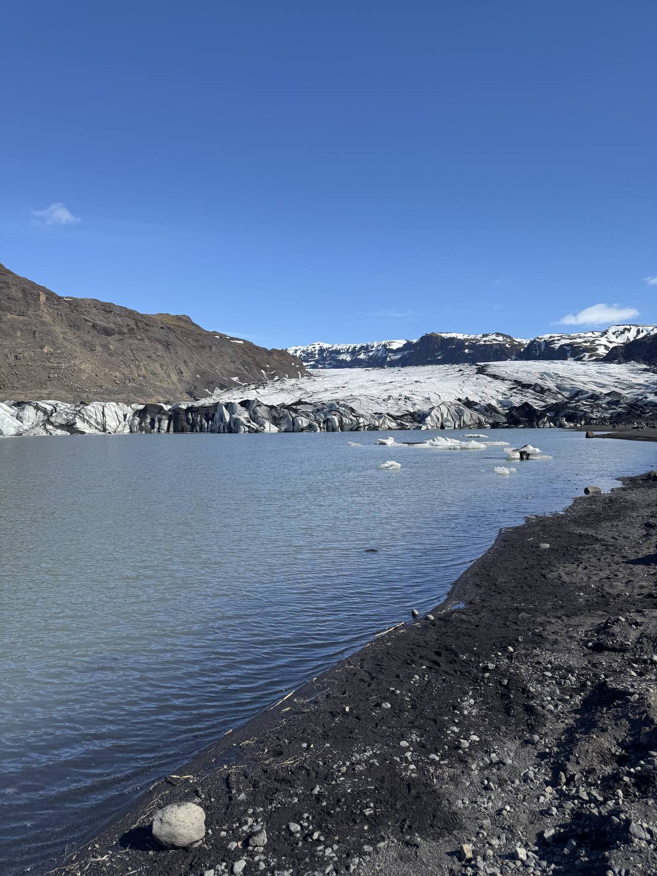
The first time most people see a real glacier up close, they go quiet. Not because it's pretty in a postcard way, because Sólheimajökull is not pretty in a postcard way. It is grey, streaked black with old volcanic ash, cracked and dirty and enormous, and it sits at the end of a short gravel path with a still lagoon of meltwater in front of it. That contrast between what you imagined and what you actually get is why I love bringing people here.
Sólheimajökull is a glacier tongue, an outlet arm that flows down off Mýrdalsjökull, one of Iceland's big ice caps. Mýrdalsjökull sits on top of the Katla volcano, which is part of why the ice carries so much dark ash. Stand at the viewpoint and you are looking at a river of ice that started high on a volcano and crawled toward you over a very long time.
What actually happens at the Sólheimajökull stop?
On the full-day South Coast route, Sólheimajökull is a viewpoint stop, not an ice-walk. The bus parks, and a short flat-to-gently-rising path of ten to fifteen minutes brings you out to where the ice meets the lagoon. You get roughly 45 minutes on the ground, enough to reach the ice, take it in, and walk back.
That time is enough to walk to the viewpoint, take it in, get your photos, read the interpretive signs, and walk back. It is not enough to strap on crampons and go up onto the glacier itself, and the tour is not built to do that. If walking the ice is exactly what you came for, it runs as a separate guided trip from the same car park; check that Sólheimajökull glacier hike and its dates here, because it is a different booking from the featured day tour. If you want to know how the day's pacing balances across every stop, my colleague's rundown on whether the South Coast day trip is worth the long hours in the van lays it out stop by stop.
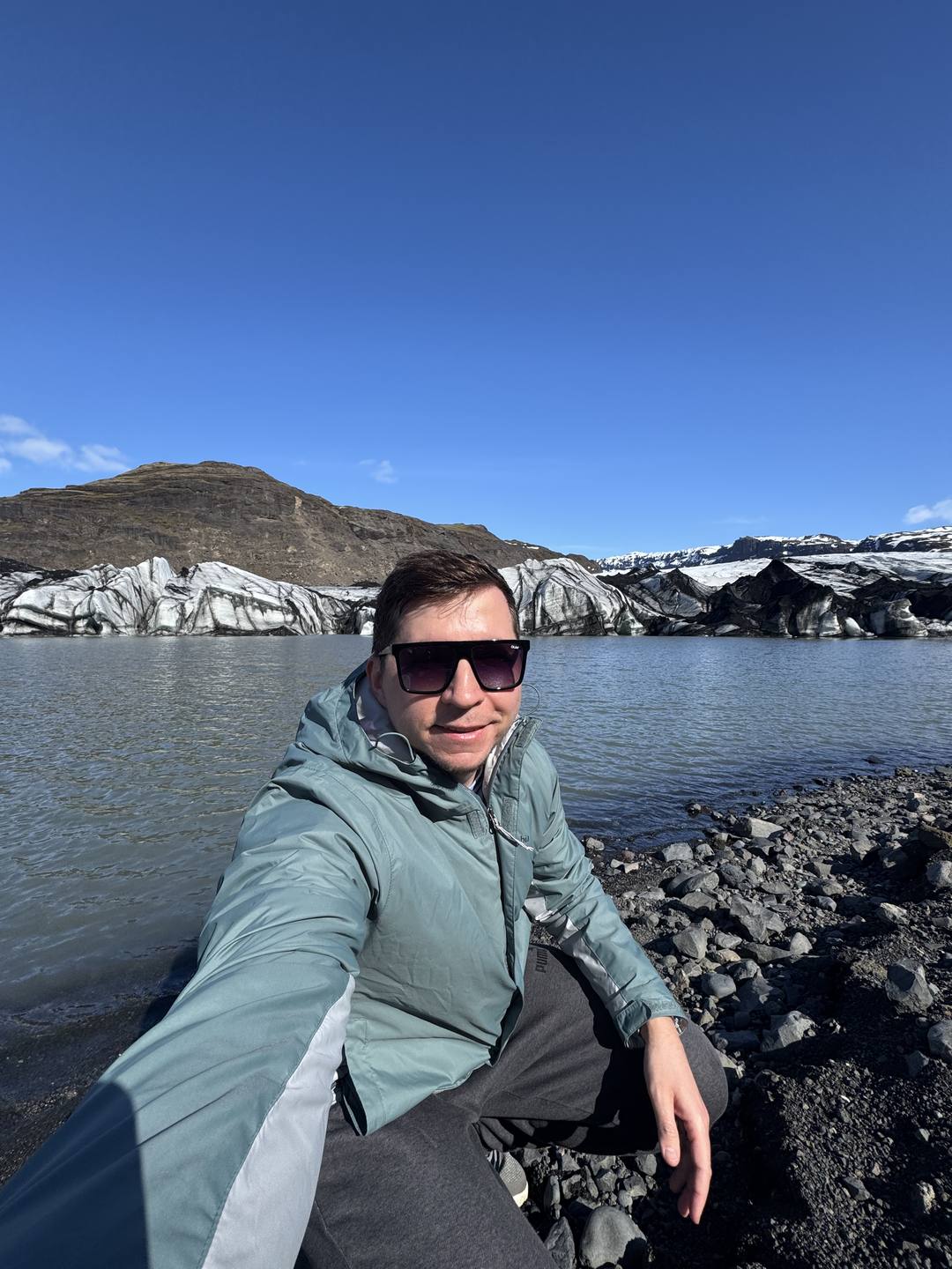
Do not let "just a viewpoint" undersell it. Standing at the edge of that lagoon, with the ice wall rising in front of you and meltwater cracking somewhere out of sight, is one of the most humbling things on the whole route. People who came expecting a quick photo stop end up staying at the rope until I call them back.
What are you actually looking at out there?
You are looking at an outlet glacier of the Mýrdalsjökull ice cap, a tongue of ice running somewhere around 8 to 11 kilometres long and 1 to 2 kilometres wide. It has pulled back roughly a kilometre since 2000, leaving the grey meltwater lagoon that now sits between the car park and the ice.
The numbers help put the scale in perspective, because your eyes will lie to you here. The ice wall looks close enough to touch and is much further and much taller than it reads. According to Perlan's glacier notes, Sólheimajökull is one of the more accessible outlet tongues of Mýrdalsjökull, which is exactly why the day tours and the hiking operators both use this valley.
| Measure | Figure |
|---|---|
| Feeds from | Mýrdalsjökull ice cap (over the Katla volcano) |
| Length | roughly 8 to 11 km |
| Width | roughly 1 to 2 km |
| Retreat since 2000 | about 1 km up the valley |
Can you actually walk on the glacier?
No, not on the sightseeing day tour, and never on your own. The day trip stops at a viewpoint only. Walking onto the ice is a separate, bookable add-on run by certified glacier operators from the same car park, using crampons, a helmet and a trained guide. Solo attempts are genuinely dangerous.
This is the question I get more than any other, so let me be very clear. What looks like solid ground can be a snow bridge over a hidden crevasse, or a thin crust over meltwater. Every year people underestimate this. The certified operators exist for a reason: they read that specific ice on that specific day, which no visitor wandering off the path can do.
| Day-tour viewpoint | Guided glacier hike add-on |
|---|---|
| Included on the full-day route | Booked separately, own time slot |
| No special gear needed | Crampons, helmet, ice axe provided |
| About 45 minutes, flat path | 2 to 3 hours on the ice |
| View the tongue from the lagoon | Walk onto the lower tongue |
| Self-guided at the viewpoint | Certified glacier guide required |
If you are weighing the sightseeing day against doing your own thing, you can check the live dates and price on Viator and see the glacier viewpoint listed among the stops, so there are no surprises about what's included. If a glacier hike is the thing you most want out of Iceland, build a separate morning around it rather than assuming the day tour covers it.
How hard is a guided glacier hike?
Moderate, and very doable for a reasonably fit beginner. You do not need to be a mountaineer. Beginner hikes spend an hour or two on the gentle lower tongue with a guide fitting your crampons and choosing a safe line. You mainly need to walk on uneven ground and follow instructions closely.
For the people who do book the add-on, that is the honest answer. Crampons feel strange for the first ten minutes and then oddly natural. You should be able to manage a few short uphill sections and keep a steady pace, and the guide handles the rest. My teammate's piece on what to actually pack for this route applies double at the glacier, where wind off the ice makes it feel colder than the car park did.
Decided to try it? See live dates and prices for the guided glacier walk
★ 4.8 · 165 GetYourGuide reviews · Sólheimajökull: Guided Glacier Hike
How much is the glacier actually shrinking?
A lot, and visibly. Sólheimajökull has retreated roughly a kilometre since 2000, in some years by as much as 50 metres, and the lagoon in front of it has grown as the ice pulled back and meltwater pooled. You can measure it against old markers and old photographs on the spot.
If you have seen photos of Sólheimajökull from ten or twenty years ago, you will notice the ice does not reach where it used to. This is not an abstract climate headline out here, it is something you can stand next to. I point it out on every visit, because the glacier is honestly one of the clearest, most sobering climate lessons anywhere on the route.
How do you stay safe at the glacier lagoon?
Stay behind any ropes or marked lines and keep well back from the water's edge. The shore is soft, the lagoon is deeper and colder than it looks, and ice calves off without warning. Never climb onto floating ice for a photo. Cold-water shock is fast and can be fatal.
The viewpoint is safe when you respect it, and it bites when you don't. Iceland's landscapes are open and unfenced by design, which is glorious, and it means the responsibility sits with you. The national guidance at safetravel.is says the same thing about every glacier margin in the country: admire it from solid ground.
| Do | Don't |
|---|---|
| Stay behind ropes and marked lines | Step onto floating ice for a photo |
| Keep back from the soft lagoon shore | Assume the water is shallow |
| Watch for calving ice and stay clear | Turn your back on the ice wall |
| Follow your guide's called boundaries | Wander off the marked path alone |
This is the same respect the whole South Coast asks of you. The black beach at Reynisfjara later in the day carries its own serious hazard with sneaker waves, and I would put reading up on why Reynisfjara catches people out on your list before you go.
How do you make the most of your 45 minutes?
Walk out to the viewpoint first, before you stop for photos, so you actually reach the ice rather than still ambling when the guide waves everyone back. Give your eyes a minute to adjust to the scale, look for the ash layers striped through the ice, and take a moment without the phone.
The ice is bigger and further than it first reads, so covering the ground early is the trick. Each dark stripe through the ice is a record of an eruption, which is worth a second look once you know what you are seeing. For a fuller sense of how this stop sits inside a real day out here, have a look at the things I wish I'd known before my first South Coast run. When you are ready to lock in the day, the full itinerary and pickup points live on the South Coast small-group tour page.
Can you walk on Sólheimajökull?
Not on the sightseeing day tour, which only stops at a viewpoint over the glacier. Walking onto the ice is a separate, bookable glacier-hike add-on that requires crampons, a helmet and a certified guide. Never attempt to walk on the glacier alone, as hidden crevasses and thin ice make it genuinely dangerous.
How hard is the glacier hike?
The guided beginner hikes are moderate and doable for a reasonably fit first-timer. You spend an hour or two on the gentler lower tongue, with the guide fitting your crampons and picking a safe route. You mainly need to walk on uneven ground for a couple of hours, handle a few short climbs and dress in warm, waterproof layers.
Is the Sólheimajökull stop worth it if it's only a viewpoint?
Yes. Standing at the lagoon with the ash-streaked ice wall in front of you is one of the most humbling stops on the South Coast, even without going onto the ice. You get roughly 45 minutes, enough for the short walk out, the viewpoint and photos.
Why is the glacier grey and dirty instead of white?
Sólheimajökull flows off the Mýrdalsjökull ice cap, which sits on the Katla volcano. Old layers of volcanic ash are frozen into the ice, so the surface reads grey and black rather than clean white. Those dark stripes are a visible record of past eruptions.
Booking
See The Glacier, Or Walk On It
Iceland South Coast Full Day Small-Group Tour
★ 4.8 · 6,610 Viator reviews · Your Day Tours
The viewpoint walk is built into the small-group day, and the walk on the ice itself is one separate booking from the same car park if you want both angles on the glacier.
- About 10 hours
- Max 19
- Free cancellation up to 24 hours before
Check Live Availability & Prices on Viator →
Affiliate link: if you book through it we may earn a commission at no extra cost to you. How this works.
Not sure which option fits? Answer 3 quick questions
General guidance, no answers needed: the featured small-group day fits most first visits to the South Coast. Pick a month and your priorities for a tailored pick, and confirm dates and restrictions on the listing.
Compare the other options (2)
Each is a separate Viator or Expedia booking, not part of the featured day tour.
Sólheimajökull Small-Group Glacier Hike — Crampons, helmet and a certified guide on the lower tongue of the glacier the day tour only views. ★ 4.8 · 565 Viator reviews · 3-4 hours
Katla Ice Cave Under the Volcano, from Vík — Super-jeep from Vík up under Mýrdalsjökull into the ice cave beneath the Katla volcano. ★ 4.7 · 1,193 Viator reviews · From Vík
Pick your date next: summer glacier-hike slots and day-tour seats are both booked per date, so check both listings before you fix your itinerary.
Pick your date
Scheduled departure dates from the operator's Viator calendar. Availability for your date and the final price are confirmed on the listing.
Check Live Availability & Prices →The departure calendar could not load just now. Check dates and prices directly on the listing:
Check Dates & Prices on Viator →